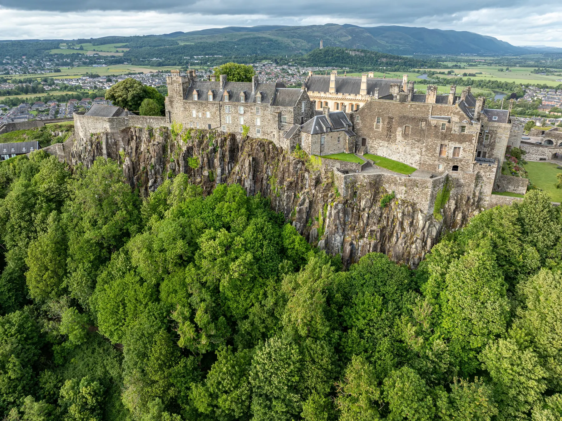
Stirling is built on a volcanic crag above a bend in the River Forth, with the Ochil Hills rising a few kilometres to the north-east and the Trossachs beginning half an hour west. That gives it an unusual range of walking for a city of thirty-seven thousand people: a historic town walk you can do in an hour, a hill with a monument on it, a proper 400-metre summit within sight of the castle, and one of the finest raised bogs in Europe on the plain below.
The geography also explains the city. The Forth was bridgeable here and nowhere lower, which made Stirling the gateway between the Lowlands and the Highlands — and the reason two of Scotland’s most famous battles were fought within three kilometres of the castle.
Distances are from the town centre.
The essential Stirling walk, and it takes about an hour. A path follows the line of the sixteenth-century town wall — among the best-preserved burgh defences in Scotland — around the base of the castle crag, climbing gradually from the bottom of the old town to the castle esplanade.
On the way it passes the Beheading Stone on Mote Hill, the cemeteries below the castle with the extraordinary Star Pyramid and the Martyrs’ monuments among them, and gives views over the Forth valley the whole way. It is free, it is signposted, and it is the best introduction to the town.
From the castle esplanade down Castle Wynd and Broad Street to the bottom of the hill, past:
Argyll’s Lodging, the finest surviving seventeenth-century townhouse in Scotland.
Mar’s Wark, the ruined Renaissance front of a great townhouse begun in the 1570s and never finished.
The Church of the Holy Rude, where the infant James VI was crowned in 1567 — one of very few churches in Britain still in use that has hosted a coronation. It still shows musket damage from the Civil War siege.
The Old Town Jail, a Victorian prison now run as an attraction with a viewing tower.
South-west of the castle, King’s Park was the royal hunting park and is now the city’s main green space. Below the castle rock lies the King’s Knot — a set of grassed earthwork terraces in a geometric pattern, the surviving earthworks of a formal royal garden laid out in the 1620s. Best seen from the castle walls above, where the whole pattern reads.
A kilometre and a half east, on a meander of the Forth reached by a footbridge from Riverside. The Augustinian abbey was founded in the twelfth century and was where Bruce held a parliament after Bannockburn; James III and his queen are buried here. What survives is a fine detached bell tower and the outlines of the rest, in a quiet field by the river.
Free, and almost nobody goes.
Three kilometres north-east. Abbey Craig is the wooded volcanic hill from which William Wallace is said to have watched the English army crossing Stirling Bridge in 1297, and the National Wallace Monument — a 67-metre Victorian Gothic tower — stands on its shoulder.
The walk up through the woods from the car park takes twenty minutes and is free; the monument charges. There are 246 steps inside it to a crown-shaped viewing platform, and the view takes in the whole Forth valley, the castle, Bannockburn, the Ochils and the Highlands beyond. See our Wallace Monument page.
The western end of the Ochil Hills, 418 metres, and the local hill. The usual route starts from the Sheriffmuir road above Bridge of Allan and takes about two hours round trip on a good path with a steep final section. The summit view over the Forth valley, the castle and away to Loch Lomond is the best in the district.
It is the hill Stirling students climb, and there is a well-worn tradition of doing so at sunrise.
Ten kilometres east along the foot of the Ochils, Alva Glen is a steep wooded ravine with waterfalls, footbridges and a path climbing beside the burn — one of a series of “hillfoots” glens cut into the escarpment, and the best of them. Menstrie, Tillicoultry and Dollar have their own; Dollar Glen leads up to Castle Campbell, which is spectacular.
The Ochil escarpment rises abruptly from the flat carse, so the climbs are short and steep and the views are out of proportion to the height.
Fifteen kilometres west, and something you will not see elsewhere: one of the largest and best-preserved raised bogs in Europe, with a boardwalk trail and a viewing tower. It is flat, it is strange, and it is a national nature reserve. Free.
The flood plain west of the city — the carse — is dead level, drained farmland threaded by the meandering Forth. Riverside paths run from the city out towards Cambuskenneth and the university, and the Stirling to Alloa and Stirling to Dunblane routes give level walking and cycling.
Trains run to Dunblane, Bridge of Allan, Alloa, Edinburgh, Glasgow and Perth from a station in the middle of the city, which makes linear walks easy.
Buses serve the hillfoots villages, Doune and the Trossachs.
Parking for the Wallace Monument and Alva Glen is charged; the Back Walk and the town walks need none.
The Ochils are steep and the glens are slippery when wet. Dumyat is a small hill with a real summit and deserves proper footwear.
Season. The hillfoots glens are best after rain, when the waterfalls run; Flanders Moss is best in autumn.
Spring is when the hillfoots glens are at their best — the burns are full from the winter, the wild garlic is out in Alva and Dollar, and the Ochils are green before the bracken.
Summer brings the long Scottish evenings, and the Back Walk or Abbey Craig at nine in the evening in June is one of the pleasures of a Stirling summer. It is also midge season in the wooded glens.
Autumn is the best walking of the year: the carse turns, the Ochils go bronze, and the light on the castle crag from Abbey Craig in October is worth the climb on its own.
Winter brings the shortest days but the clearest air, and the view from Dumyat or the Wallace Monument on a cold bright day reaches the Highlands.
The flat land west of the city is not just farmland. The carse is reclaimed floodplain and the Forth meanders through it in enormous loops, which makes the riverside walks unusually rich: herons, swans, otters on the quieter stretches, and large numbers of geese in winter.
Flanders Moss, the raised bog fifteen kilometres west, is a national nature reserve holding species that live nowhere else in the area — including adders, which are worth being aware of rather than worried about.
And on the hills: red kites and buzzards are common over the Ochils, and there are deer in the woods on Abbey Craig and around Doune.
The Back Walk round the town wall for an hour; Abbey Craig and the Wallace Monument for the view; Dumyat if you want a hill.
About two hours round trip from the Sheriffmuir road, with a steep final section.
The walk up Abbey Craig through the woods is free; entry to the monument and its 246 steps is charged.
A kilometre and a half east of the centre, across a footbridge over the Forth. Free and usually empty.
The riverside paths, the carse west of the city and the boardwalk at Flanders Moss are all level.